For the 2024/25 academic year, students were asked to devise an activity or event that would introduce students (many of whom will be voting, or have just voted, for the first time) to London’s representative and democratic past. In a city rich with political and electoral history the group were tasked with deciding which stories to tell, as well as how best to present this information to the desired audience.
The group decided to produce a digital interactive map, highlighting some of the key sites of 19th and 20th century political activity in the capital. The case studies were organised into five different themes, demonstrated by different colours on the map:
- Working class men
- Colonial and global protests
- Students in higher education
- Migrants and ethnic minority groups
- Middle and working class women
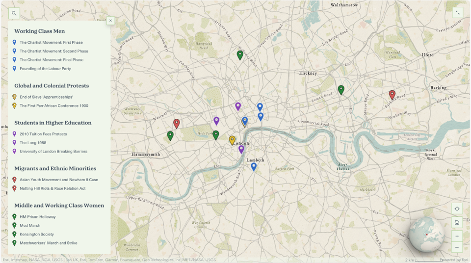
When clicking on the map point in Kennington, users could learn about the early phases of the Chartist movement and their mass petition submitted to Parliament in 1839. Or, when clicking the purple mark in Bloomsbury, users could read about the history of the University of London and how it gave graduates the opportunity to vote.
This project was established as a prototype for the type of content that the History of Parliament could utilise on our website, and something that could be continually added to.
The interactive map is sadly no longer available to view, as the software has been retired.
